Sunday, 3 April 2016

Roads- the Wires of a City


“Urban form can be understood at different levels of resolution. Commonly, four are recognized, corresponding to the building/lot, the street/block, the city and the region.” – Moudon, A.V (1994)
Since the dawn of man, urban morphology has been a theme in human history. Since the urban revolution in 4th millennium B.C. Mesopotamia, cities form the largest artifacts ever produced by humans and their most dominant socio-spatial entity. Despite its archaic origin, urbanism survived all subsequent socio-cultural changes: It was the most dominant cultural, social and political spatial entity for the Sumerian, Acadians, Hittites, Egyptians, Greeks, Romans, Byzantines, Persians, Chinese, Moslems and Middle-Ages Europeans (J. Amos 1996). In this urban wire, we explore the nature and morphology of cities. Like a circuit, made up of wires; string-like pieces or filaments of relatively rigid or flexible metals, used chiefly for structural support, the patterns of its component parts and the process of its development must be examined to fully understand the spatial structure and character of a city. According to (J. Amos 1996) Portugali, cities should be seen in terms of networks, stretching in time and space.
Construction in urban centers is an integral part of its development; it includes both buildings and roads. The construction of roads involves the removal of geographic obstacles and the use of new construction materials that are far more improved and durable (Goel 2013 ). There are a six steps to the construction of roads, firstly preparation of sub-grade, then the preparation of sub-base and base, as well as the preparation of wearing course and shoulders then finally opening up to traffic.
The digging up of the sub soil provides the sub-grade which is then compacted by rollers weighing eight tones by sprinkling water one night before (civilblog.org 2015). On this compacted sub-grade, boulders, broken stones or burnt bricks are spread in layers of 15cm thickness and then compacted once more to form the sub-base. Specified materials are then spread on the sub-base and proper grade, thickness and cross sections are maintained. The wearing course could be laid down in either one or two layers, however each layer must not exceed 10cm. Shoulders are then created by filling the earth to the specified cross slope and then compacting it. After drying the road is open to traffic. Roads are constructed in city centers for ease of access to and from it and are essential for the daily operations of citizens.

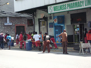
The area under construction shown in the pictures was taken on the corner of Charlotte Street and Independence Square which is the southern part of the Central Business District of the city of Port of Spain. It was taken on February 2nd at around 12:30pm. The workers seen belong to the Port of Spain City Corporation and are reconstructing the pavement for pedestrian use.  Due to the rise in the price of oil in the early 1970s, Trinidad and Tobago was provided with the capital to finance development. Much of the development programme that was launched involved construction work.

References:
civilblog.org. june 20, 2015. http://civilblog.org/2015/06/20/6-basic-steps-comprising-wbm-road-construction-procedure/ (accessed february 29, 2016).

Goel, Tarun. Bright Hub Engineering . May 2013 . http://www.brighthubengineering.com/structural-engineering/59665-road-construction-history-and-procedure/ (accessed February 2016).

J. Amos, L.S Brune and J.Portugali. "Notions concerning the nature of world urbanization, in Perspectives on Urbanization." Progress in Planning, 1996: 145-162.

Saturday, 2 April 2016


"In urbanization, you think big because you are thinking decades ahead." - Kushal Pal Singh
Which cities have the greatest chance of flourishing in the forthcoming decade? The question is an intricate one, and as the economy changes, so too, will the best situated cities. In the study of urban morphology, we aim to show construction sites and why they are situated where they are and their functions.
                                                     
Let's have a look at the city of Port of Spain, the present government has employed many contractors to construct more buildings to facilitate government offices. The construction site shown in the pictures above is one of many found in Port of Spain. At the site an interview was conducted with two of the workers, namely Fabian Lewis and Sunil Lochan. They informed us that construction began with the People’s National Movement (PNM) in 2005, but stopped when the United National Congress (UNC) came into power in 2015. However, in 2015 when the PNM regained power construction continued. The building is meant to be a government complex solely for the purpose of government offices. It is expected to finish next year, 2017.

Friday, 1 April 2016

The Cathedral of the Immaculate Conception

The image above shows the Cathedral of Immaculate Conception which is a Roman Catholic Church located in Independence Square Port of Spain and was the first Catholic Church in the city. On March 25th 1816, the foundation stone was laid by the country’s first civilian Governor Sir Ralph Woodford and the building was then completed in 1836. The Cathedral was built in the shape of a cross and the walls made of limestone from Laventille Hills. Beneath the Cathedral is the crypt that houses the remains of more than 15 high ranking Catholic Church officials including archbishops.
The Cathedral runs educational development programmes for school children, daily religious services, bible study and marriage preparation classes. (Taylor 2011). The Cathedral is newly renovated after being closed for the last three and a half years. It was closed in 2012 after it was a decided that it was no longer safe for worship and occupation due to severe water damage. The Cathedral reopened April 2016 for Easter celebrations

Churches have a role to play in the city (Lorne 2012) states that churches often occupy a geographically central location in cities and they inherit many of the social issues of the urban core. This explains why these churches focus on helping the homeless and offering developmental programs like the Cathedral of the Immaculate Conception.  Churches also add an aesthetic aspect to the city because of their outstanding and remarkable appearance. They have history that most times date back to before the city became developed. 
 source: http://www.guardian.co.tt/lifestyle/2014-04-20/part-1-cathedral-immaculate-conception
The picture above shows the Cathedral during the 1800’s where there is a clear demarcation in the economic activity around it. Independence Square today has a greater level of economic activity and is definitely more intense than the 19th century. Sjoberg’s theory explained that churches and other sacred institutions dominate most of the cultural landscape as well as the cultural beliefs of the urban place. 
References: 
Lorne, Daniel. Rethink Urban. September 12, 2012. http://rethinkurban.com/2012/places-and-spaces/a-second-look-at-the-churches-in-the-city/ (accessed April 8, 2016).

Taylor, Caroline. Caribbean Beat . 2011. http://caribbean-beat.com/issue-112/saving-soul-city#axzz45G94qAdZ (accessed 2016).

Wednesday, 30 March 2016

Functions of a city


“There is no logic that can be superimposed on the city; people make it, and it is to them, not buildings, that we must fit our plans.” – Jane Jacobs


The reason, job or purpose for existing can be termed as the function of an area. In urban form this narrates to the purpose of a land use for suburban areas, leisure and commerce. The principal purpose in cities differs, for example Newcastle is now making an effort to be a science city, whereas London is known for its function as a fiscal centre. With this being said, functions can be modified over time, in Newcastle the original function was a coal mining region, which then transformed to heavy industry and manufacturing with ship building and weaponries at the forefront, with technological industries and education dominating presently.
Let’s have a look at the borough of Arima – likely to follow in the footsteps of the city of San Fernando, Arima too may eventually graduate from a borough into a city as the town possess several important functions. Such city functions may include the provision of jobs in industry or service, the use as an entertainment and cultural centre (offers sporting attractions, shopping areas and restaurants), as well as a residential and religious centres and lastly as a major transportation hub. 


Arima plays a significant role for North Eastern Trinidad as the key terrestrial transportation wires are the Churchill Roosevelt Highway (CRH), the Priority Bus Route (PBR) and Eastern Main Road (EMR) which all link Arima to strategic cities and towns of the circuit in this urban wire. The picture above shows the red band maxi taxis on the corner of Green Street, Arima, as they await commuters heading west side.


Moreover, the district of Arima contains significant historical sites which involve the displays of the Caribs and Amerindians within Arima in Santa Rosa Carib Centre and Cleaver woods respectively. In addition to the religious sites, Arima also harbours three major sporting arenas, namely the Santa Rosa Race Track, Arima Velodrome and the Larry Gomes Stadium.
References 
Gamesby, Robert. "Urban Functions." Urban Functions. N.p., n.d. “Date Retrieved” 29 Mar. 2016.


 "Most Recent News." Arima Borough Corporation. “Date Retrieved” 29 Mar. 2016.


Tuesday, 29 March 2016

The Evolution of Transportation


Photo Courtesy: Glen Beadon

The auto industry must acknowledge that a rational transportation policy should seek a balance between individual convenience, the efficient use of limited resources, and urban-living values that protect spaciousness, natural beauty, and human-scale mobility.” Stewart Udall

According to Allen Morrison in “The Trams and Trolleybuses of Trinidad and Tobago” the first railway on Trinidad island was a horse-drawn line called the Cipero Tramway, which was constructed in the 1840's by a Scottish planter named William Eccles to transport produce from his sugar plantation to the wharf at San Fernando, 30 miles south of Port of Spain. On March 5th, 1859, Tramcars had begun transporting commuters along the first four miles of the line, from San Fernando to Sainte Madeleine. By 1864, Steam locomotives replaced the animals and towed the cars to Princes Town. San Fernando and Port of Spain were not linked by railroad up until 1882. The Cipero Tramway was eventually engrossed by the Trinidad Government Railways system, which operated until 1968. Exhibited today on Harris Promenade in San Fernando is TGR’s last steam engine.

Transportation is a fundamental part of urban morphology. In the urban circuit of Port of Spain, we can see how these roadways are used like wires to connect every aspect of the city. Looking at the city in the present day, we can see how the transport networks have evolved. The same way animals had been replaced by steam locomotives, they too had been replaced by open electric cars in 1883. The electric cars were eventually replaced by trolleybuses in 1939 which were then replaced by what we know today as the Public Transport Service Corporation (PTSC) in 1965. This can be seen in the photos above as an Electric Trolleybus once made headlines as a form of transportation prowess in the 1930's but is no longer existent as the new Compressed Natural Gas (CNG) buses and maxi taxis are presently the main public transport mediums on the island.

Accessibility is the foundation of economic expansion in cities. Although urban form and transportation may seem to be detached, they are in fact, in each other's pocket.  In order to access good and services transport is greatly needed, the more efficient, the greater the economic profits. Let’s have a look at the cities of Trinidad; according to buzz.tt, the city of San Fernando is the larger of the two cities in Trinidad and Tobago covering 18.64 km²  whilst the nation’s capital Port of Spain, covers 13.45 km². Over the years, the transportation routes and mediums had to evolve to facilitate the increasing populace as urban form, the arrangement and concentration of land uses, and transportation schemes are the features of cities that govern the ways in which individuals interact with each other.

References·         

City Hall of San Fernando in San Fernando - ID 652." City Hall of San Fernando in San Fernando. 2016 Buzz Media Ltd., “Date Retrieved” 26 Mar. 2016.

 "City Observatory." City Observatory. N.p., 14 Oct. 2014. “Date Retrieved” 26 Mar. 2016.

Morrison, Allen. "THE TRAMWAYS OF TRINIDAD & TOBAGO." THE TRAMWAYS OF TRINIDAD & TOBAGO. Copyright 2008-2108 Allen Morrison TODOS LOS DERECHOS RESERVADOS, 1 Sept. 2008. “Date Retrieved” 26 Mar. 2016.

 Rode, Philipp, and Graham Floater. "ACCESSIBILITY IN CITIES: TRANSPORT AND URBAN FORM."

 www.brainyquote.com/quotes/keywords/transportation. “Date Retrieved” 26 Mar. 2016.

Friday, 25 March 2016

Services of a city


“In great cities, spaces as well as places are designed and built: walking, witnessing, being in public, are as much part of the design and purpose as is being inside to eat, sleep, make shoes or love or music. The word citizen has to do with cities, and the ideal city is organized around citizenship -- around participation in public life.” -Rebecca Solnit, Wanderlust: A History of Walking.

Cities provide many services such as hospitals, parks, housing, transportation routes, police and fire. In the photos above, the old Arima police station is standing alongside the modern station.  In 2011, a budget allocation of $1.6 billion had been given to the Trinidad and Tobago Police Service which was used for construction projects in 2012.  Although many of the old stations were demolished, the old Arima Station still stands, showing the clear difference in time and form of place then and now. From the pictures above once can see huge differences between the two buildings. The old building consisted of wooden shutters and iron doors while the modern building has glass windows and doors. The newly constructed  stations provides a two-storey building with additional space for offices and upgraded property rooms with the installation of shelving and racking storage.

As the population in towns and cities continue to grow so too must the services in order to facilitate demands. The planning of construction and refurbishment of services within a city is an integral part in the study of urban morphology.
According to Denyse Renne in"Police Service Gets $1.6b Share", twenty million dollars was used for the purchasing of vehicles and equipment, which included marked sedans and sport utility vehicles "required to adequately support the operations and facilitate the implementation of the 21st century policing initiative
 References 
Ministry of National Security. n.d. Web. 21 Mar. 2016.

Renne, Denyse. "Police Service Gets $1.6b Share." Trinidad Express Newspapers:. N.p., 12 Oct. 2011. Web. 21 Mar. 2016.

Thursday, 17 March 2016

The ecological footprint of a city


One thing is sure. The earth is now more cultivated and developed than ever before. There is more farming with pure force, swamps are drying up, and cities are springing up on unprecedented scale. We’ve become a burden to our planet. Resources are becoming scarce, and soon nature will no longer be able to satisfy our needs.” Quintus Septimus Florens Tertullianus, Roman theologian, 200 AD

  Studies recorded in the journal Psychological Science has shown that living in greener spaces possess significant positive effects. According to BBC News, Dr Mathew White and his research team at the European Centre for the Environment and Human Health examined data from a national survey that followed more than 5,000 UK households and 10,000 adults between 1991 and 2008 as they moved house around the country. It was found that the individuals reported less mental distress and higher life satisfaction when they were living in greener spaces. These findings could aid in informing urban planners and have an overall impact on society.

In the paper “Ecological footprints and appropriated carrying capacity: what urban economics leaves out” by William E. Rees, Rees uses the concepts of human carrying capacity and natural capital to debate that prevailing economic assumptions in regards to urbanization and the sustainability of cities must be reviewed in light of global ecological change. 
The picture above shows a green space within the Central Business District of Arima. This park connects small retail shops, a sporting centre and market to each other. in the background the market can be seen to the left and the well-known Arima Velodrome is situated at the right. Green spaces like this are beneficial to our environment as they act as an air filter, purifying the air around us whilst providing shade and lowering temperatures in urbanized areas. 
References
"Green Spaces Boosts Wellbeing of Urban Dwellers - Study." BBC News. BBC, 22 Apr. 2013. “Date Retrieved” 16 Mar. 2016.

Rees, W. E. "Ecological Footprints and Appropriated Carrying Capacity: What Urban Economics Leaves out." Environment and Urbanization 4.2 (1992): 121-30. “Date Retrieved” 16 Mar. 2016.


"Twenty-five of the Best Urbanism Quotes." This Big City Twentyfive of the Best Urbanism Quotes Comments. N.p., 19 July 2011. “Date Retrieved” 16 Mar. 2016.